Sponsored

Chad1376

Active Member
First Name
Chad
Joined
Dec 27, 2022
Threads
1
Messages
26
Reaction score
111
Location
Henderson, Nevada
Vehicle(s)
2022 Mojave
Occupation
Civil Engineer
This is a work in progress. I'll make updates as I go. The hardware part should be easy to follow. GIS stuff requires some fundamental knowledge that's too much to explain in detail here.

I really hate cell phone apps, and the need to have internet access really hinders what's available without pre-planning to have offline maps loaded before an expedition. I tried OnX - hated it.

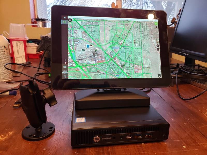
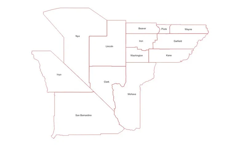
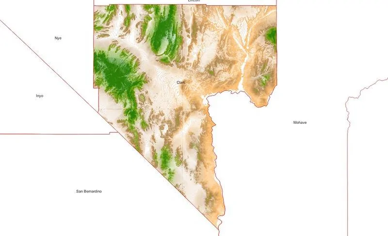
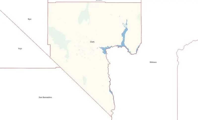
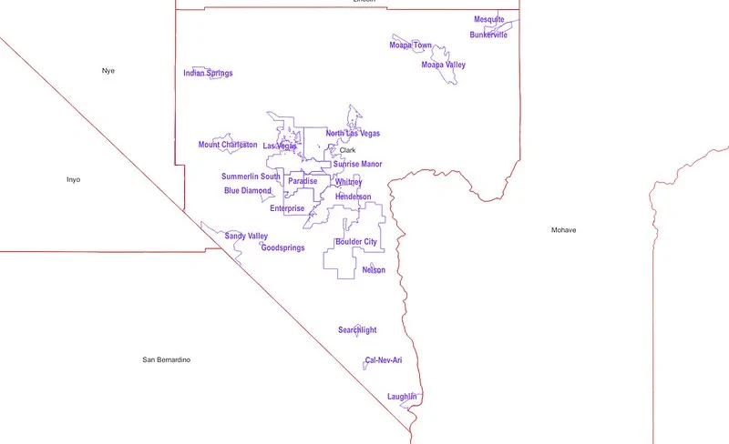
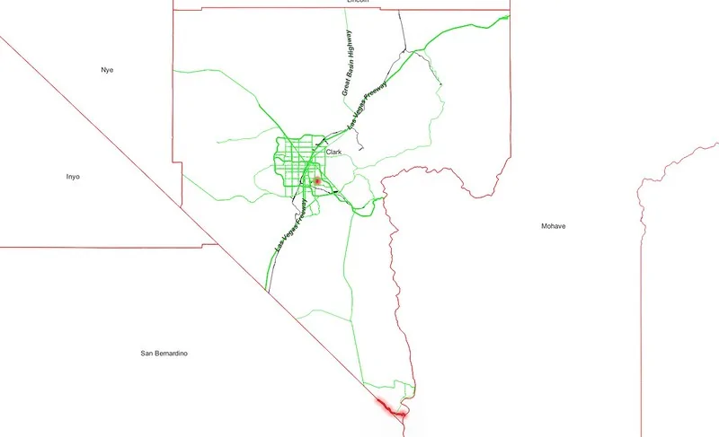
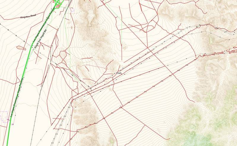
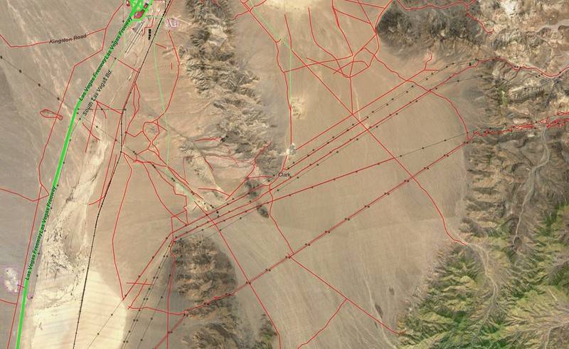
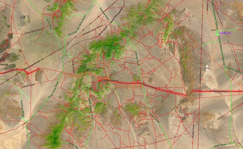
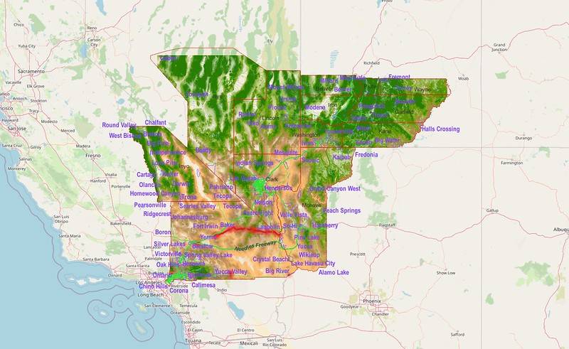
Being a geek, I'm building a "carputer" to run GIS software. Topo is from USGS, roads and trails are from the Open Steet Map (OSM) project. There's other bits of data too, like county lines from other sources. This is all open source / public info (free), but requires no small amount of processing to chop up the data into manageable bits and customize the look. Processing of GIS is via QGIS (Open Source) and is displayed in QField (Open Source). If internet is available, aerial from Google can be displayed with a cell phone hot-spot.

Hardware:
An off-lease HP EliteDesk 800 G2 Mini with an i7-6700T 32gb ram, and an nvme drive (ebay)
A Mimo Vue 10.1 HD Capacitive Touch Display (ebay)
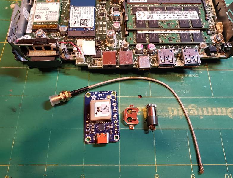
GPS reciver - I'll detail that when the unit arives
Monitor will be mounted using RAM's mounting stuff. I'll detail that when it comes in.
The PC will need to be mounted under one of the passenger seats.
Wiring - I still haven't figured out the cleanest approach yet.

Jeep Gladiator JeePS - Offline Trail Carputer i-DhS9nPd-L
Sponsored

 
Last edited:
OP
OP
Chad1376

Chad1376

Active Member
First Name
Chad
Joined
Dec 27, 2022
Threads
1
Messages
26
Reaction score
111
Location
Henderson, Nevada
Vehicle(s)
2022 Mojave
Occupation
Civil Engineer
Here's a rundown of the GIS data for the project:

I'm located in Clark County, Nevada, so I've assembled information for the surrounding counties. If I plan to go outside of this, I'll need to assemble more:
Jeep Gladiator JeePS - Offline Trail Carputer i-zm5gMF7-L


Focusing on Clark County, here's USGS topo. These are 20-meter contours, with color by elevation. This just helps with understanding the type of terrain involved, but isn't super detailed.
Jeep Gladiator JeePS - Offline Trail Carputer i-44pztH9-L


Then some basic shading, from Open Street Maps. There's an amazing amount of detailed area information in OSM, but I distilled it down to just desert, mountains and water. It just makes the maps a little more readable.
Jeep Gladiator JeePS - Offline Trail Carputer i-5XXjDg9-L


Town areas and names from OSM.
Jeep Gladiator JeePS - Offline Trail Carputer i-hwxKTQX-L


Roads from OSM. Settings apply filters based on the zoom level. At this scale, it's just major roadways.
Jeep Gladiator JeePS - Offline Trail Carputer i-6QfdTRL-L


Here's all that stuff at once. In closer, the detail shows up. I've simplified the roads so, in general, paved roads are green, dirt is red.
Jeep Gladiator JeePS - Offline Trail Carputer i-bmW9pnK-L


..and with Google aerial on (requiring internet.)
Jeep Gladiator JeePS - Offline Trail Carputer i-wQkWDBZ-L


Routing is kind of possible using style filters. If a road has a name, I can have the software highlight it. Most trails are not named, but It's possible to assign them a name as needed, so the highlighting filter can be used.
Jeep Gladiator JeePS - Offline Trail Carputer i-HtR6mfJ-L


The whole enchalada. Everything here, except the underlying map, is currently on the JeePS SSD and available without internet.
Jeep Gladiator JeePS - Offline Trail Carputer i-39VLSdJ-L
 
Last edited:

jerjon

Well-Known Member
First Name
JimmyJones
Joined
Jan 2, 2023
Threads
10
Messages
54
Reaction score
42
Location
Wisco
Vehicle(s)
Mojave, LJ, TJ, SuperTrooper
Occupation
Magician
Awesome! I'll buy it when it fits on a tablet and you have the continental us done! There's so ,any map apps, and everyone of them are confusing..
 
OP
OP
Chad1376

Chad1376

Active Member
First Name
Chad
Joined
Dec 27, 2022
Threads
1
Messages
26
Reaction score
111
Location
Henderson, Nevada
Vehicle(s)
2022 Mojave
Occupation
Civil Engineer
Gaia GPS. Check it out.
I played with it a little, but it looks more or less the same as OnX. It looks handy if you have cell service, but unless I grab huge areas to download for offline use, it's limited for what I want it to do.

What I'm after is to have everything I want available as soon as I boot without neccessarily pre-planning or having an internet connection.

Also - I'm a geek and enjoy the process of assembling this. My best analogy is I'm going fishing instead of heading to the grocery store. ;)
 
Last edited:

Sponsored

chorky

Well-Known Member
First Name
Chad
Joined
Feb 26, 2022
Threads
154
Messages
2,979
Reaction score
3,046
Location
Montana
Website
www.youtube.com
Vehicle(s)
'06 TJ GE, '22 JTR
Build Thread
Link
Occupation
Forester
I played with it a little, but it looks more or less the same as OnX. It looks handy if you have cell service, but unless I grab huge areas to download for offline use, it's limited for what I want it to do.

What I'm after is to have everything I want available as soon as I boot without neccessarily pre-planning or having available data.

Also - I'm a geek and enjoy the process of assembling this. My best analogy is I'm going fishing instead of heading to the grocery store. ;)
Sounds like you know a little bit about gis, which is cool. And we have the same name, which is weird…

You might want to look into caltopo. it is much more advanced than onx or gaia and allows you to actually run dome gis analysis which is super helpful for finding cool spots.

But if you really want to use gis you should look into ArcPro by Esri. Its much improved over arc map except some geoprocessing options and add-ins are not yet supported. But I would be willing to bet there are some maps already made for visitor use in that area that may be publicly accessible.

Or you can make your own and publish them to gisonline and use with field maps which is available for offline use. So if you happen to have access to NAIP imagery that would be a big plus. Although the sat imagery via caltopo is much better than google aerial which is used on gaia.

If you already are using ArcPro and have access to data I would suggest making your own feature service and publishing to gisonline, which is free for a certain amount of data, and then using field maps. Field maps is a really cool application with a lot of flexability. Heck you could even start a survey123 program to assess your own trips and run some analytical stats which would be sweet.

Then there is a simpler option of using the interactive maps offered by the forest service which shows basic information but does allow you to export georeferenced pdf maps to use on Avensa.
 

chorky

Well-Known Member
First Name
Chad
Joined
Feb 26, 2022
Threads
154
Messages
2,979
Reaction score
3,046
Location
Montana
Website
www.youtube.com
Vehicle(s)
'06 TJ GE, '22 JTR
Build Thread
Link
Occupation
Forester
Also, I am sure there is point cloud data or already stitched LiDAR for those areas you are looking into which would be an awesome bit of data to make some slope and elevation rasters! Or even analyze for an estimated viewpoint of a potential campsite! Which is easily done in caltopo
 

TroutFishingInAmerica

Well-Known Member
Joined
Jul 19, 2020
Threads
18
Messages
759
Reaction score
1,215
Location
The Great Pacific Northwest
Vehicle(s)
Mojave
I played with it a little, but it looks more or less the same as OnX. It looks handy if you have cell service, but unless I grab huge areas to download for offline use, it's limited for what I want it to do.

What I'm after is to have everything I want available as soon as I boot without neccessarily pre-planning or having an internet connection.

Also - I'm a geek and enjoy the process of assembling this. My best analogy is I'm going fishing instead of heading to the grocery store. ;)
Maps are all downloadable, no cell necessary. I absolutely understand your analogy, have fun!
 
OP
OP
Chad1376

Chad1376

Active Member
First Name
Chad
Joined
Dec 27, 2022
Threads
1
Messages
26
Reaction score
111
Location
Henderson, Nevada
Vehicle(s)
2022 Mojave
Occupation
Civil Engineer
Good stuff - I'll look into some of these more. I'm always on the hunt for sources of good data.

One goal with this, also, is to eliminate the need for commercial software or services. ERSI stuff is great, but also expensive. QGIS is free, exceptionally powerfull, and I know it inside and out.

QField looks like the open source equivilant of Feild Maps that works with QGIS style formatting. All I'm after here is a simple interface that opens the files and has an easy pinch/zoom touch screen interface.

NAIP imagary - I've used it alot on a smaller scale, but the files are huge. To download and store imagary over the areas I'm compiling would take days to download and require a huge amount of storage space. I may grab some for limited areas where I'm more likely to off-road though.
 

chorky

Well-Known Member
First Name
Chad
Joined
Feb 26, 2022
Threads
154
Messages
2,979
Reaction score
3,046
Location
Montana
Website
www.youtube.com
Vehicle(s)
'06 TJ GE, '22 JTR
Build Thread
Link
Occupation
Forester
Yeah qgis is pretty powerful but being a gov employee i am on arc all the time. Im not sure if qgis is able to analyze and manipulate point cloud data but if it can that would be sweet to find some and get canopy height along with bare earth rasters, you could get good ideas of the forest type in a particular area before choosing to go there.
 

Sponsored

OP
OP
Chad1376

Chad1376

Active Member
First Name
Chad
Joined
Dec 27, 2022
Threads
1
Messages
26
Reaction score
111
Location
Henderson, Nevada
Vehicle(s)
2022 Mojave
Occupation
Civil Engineer
Yeah qgis is pretty powerful but being a gov employee i am on arc all the time. Im not sure if qgis is able to analyze and manipulate point cloud data but if it can that would be sweet to find some and get canopy height along with bare earth rasters, you could get good ideas of the forest type in a particular area before choosing to go there.
Forest? Is that where lots of trees grow? 90% of the places around 'Vegas are half dead creosote bushes.
..Sorry, I'm just being a smart ass now (LOL)
 

Sportsbiz

Well-Known Member
Joined
Jan 30, 2020
Threads
1
Messages
299
Reaction score
596
Location
Palm Springs
Vehicle(s)
Jeep Gladiator Rubicon
Occupation
Digital Experience Program Manager
Following. As a GIS professional I can appreciate what you're doing here.
 

Sportsbiz

Well-Known Member
Joined
Jan 30, 2020
Threads
1
Messages
299
Reaction score
596
Location
Palm Springs
Vehicle(s)
Jeep Gladiator Rubicon
Occupation
Digital Experience Program Manager
Sounds like you know a little bit about gis, which is cool. And we have the same name, which is weird…

You might want to look into caltopo. it is much more advanced than onx or gaia and allows you to actually run dome gis analysis which is super helpful for finding cool spots.

But if you really want to use gis you should look into ArcPro by Esri. Its much improved over arc map except some geoprocessing options and add-ins are not yet supported. But I would be willing to bet there are some maps already made for visitor use in that area that may be publicly accessible.

Or you can make your own and publish them to gisonline and use with field maps which is available for offline use. So if you happen to have access to NAIP imagery that would be a big plus. Although the sat imagery via caltopo is much better than google aerial which is used on gaia.

If you already are using ArcPro and have access to data I would suggest making your own feature service and publishing to gisonline, which is free for a certain amount of data, and then using field maps. Field maps is a really cool application with a lot of flexability. Heck you could even start a survey123 program to assess your own trips and run some analytical stats which would be sweet.

Then there is a simpler option of using the interactive maps offered by the forest service which shows basic information but does allow you to export georeferenced pdf maps to use on Avensa.
As an Esri employee, I appreciate this post immensely :)
 

JacobD177

Member
First Name
Jacob
Joined
Nov 1, 2021
Threads
1
Messages
21
Reaction score
30
Location
Texas
Vehicle(s)
2014 JKS
Occupation
GIS
Glad to see I’m not the only GIS guy here!
Sponsored


Top